
Austria
9071 codice postale
Dettagli del codice postale
13 luoghiCodice
Luogo
Am Teller
Regione
Kärnten
Contea
Politischer Bezirk Klagenfurt Land
Coordinate
46.5535, 14.2276
Precisione
4 / 6
Paese
Austria
Posizione
OpenStreetMap ↗


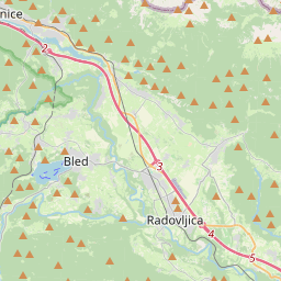

46.5535, 14.2276© OpenStreetMap
Luoghi con questo codice
13| Luogo | Regione | Contea | Coordinate |
|---|---|---|---|
| Am Teller | Kärnten | Politischer Bezirk Klagenfurt Land | 46.5535, 14.2276 |
| Köttmannsdorf | Kärnten | Politischer Bezirk Klagenfurt Land | 46.5614, 14.2339 |
| Mostitz | Kärnten | Politischer Bezirk Klagenfurt Land | 46.569, 14.2002 |
| Neusaß | Kärnten | Politischer Bezirk Klagenfurt Land | 46.5556, 14.1906 |
| Plöschenberg | Kärnten | Politischer Bezirk Klagenfurt Land | 46.5695, 14.2255 |
| Preliebl | Kärnten | Politischer Bezirk Klagenfurt Land | 46.5513, 14.2444 |
| St. Gandolf | Kärnten | Politischer Bezirk Klagenfurt Land | 46.5618, 14.2232 |
| St. Margarethen | Kärnten | Politischer Bezirk Klagenfurt Land | 46.5618, 14.2232 |
| Trabesing | Kärnten | Politischer Bezirk Klagenfurt Land | 46.5653, 14.2531 |
| Tretram | Kärnten | Politischer Bezirk Klagenfurt Land | 46.5634, 14.2609 |
| Tschachoritsch | Kärnten | Politischer Bezirk Klagenfurt Land | 46.5535, 14.2146 |
| Tschrestal | Kärnten | Politischer Bezirk Klagenfurt Land | 46.5636, 14.2 |
| Wurdach | Kärnten | Politischer Bezirk Klagenfurt Land | 46.574, 14.2043 |
Stesso codice in altri Paesi
2| Paese | Luogo | Regione |
|---|---|---|
| HU Ungheria | Gönyű | Győr-Moson-Sopron |
| NL Paesi Bassi | Alde Leie | Friesland |
FAQ
In quale città si trova 9071?
Am Teller, Kärnten, Austria.
Quali sono le coordinate di 9071?
46.5535, 14.2276
9071 è usato in altri Paesi?
Sì, in altri 2 Paesi.
I dati non sono ufficiali e presentano troncamenti noti; per le spedizioni critiche verifica con il destinatario e con il corriere. Vedi fonte e licenza dei dati → · Aggiornato il 2026-11-09. Attribuzione in