
Belgien
6941 Postleitzahl
PLZ-Details
7 OrtePLZ
Ort
Bende
Region
Wallonia
Kreis
Province du Luxembourg
Koordinaten
50.4183, 5.4146
Genauigkeit
4 / 6
Land
Belgien
Lage
OpenStreetMap ↗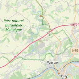


50.4183, 5.4146© OpenStreetMap
Orte unter dieser PLZ
7| Ort | Region | Kreis | Koordinaten |
|---|---|---|---|
| Bende | Wallonia | Province du Luxembourg | 50.4183, 5.4146 |
| Bomal-sur-Ourthe | Wallonia | Province du Luxembourg | 50.3763, 5.5238 |
| Borlon | Wallonia | Province du Luxembourg | 50.3784, 5.4063 |
| Heyd | Wallonia | Province du Luxembourg | 50.3462, 5.5625 |
| Izier | Wallonia | Province du Luxembourg | 50.384, 5.579 |
| Tohogne | Wallonia | Province du Luxembourg | 50.3801, 5.479 |
| Villers-Sainte-Gertrude | Wallonia | Province du Luxembourg | 50.3608, 5.5799 |
FAQ
In welcher Stadt liegt 6941?
Bende, Wallonia, Belgien.
Welche Koordinaten hat 6941?
50.4183, 5.4146
Wird 6941 auch in anderen Ländern verwendet?
Ja, in 5 weiteren Ländern.
Die Daten sind inoffiziell und gekürzt; bei kritischen Sendungen Adresse und Carrier prüfen. Quelle & Lizenz ansehen → · Aktualisiert am 2026-11-09. Quellenangabe in