
Vereinigtes Königreich
SY5 Postleitzahl
PLZ-Details
50 OrtePLZ
Ort
Acton Burnell
Region
England
Kreis
Shropshire
Koordinaten
52.6139, -2.6947
Genauigkeit
4 / 6
Land
Vereinigtes Königreich
Lage
OpenStreetMap ↗
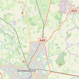
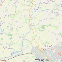

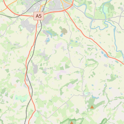
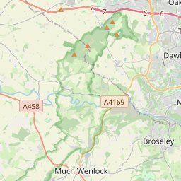


52.6139, -2.6947© OpenStreetMap
Orte unter dieser PLZ
50| Ort | Region | Kreis | Koordinaten |
|---|---|---|---|
| Acton Burnell | England | Shropshire | 52.6139, -2.6947 |
| Acton Pigott | England | Shropshire | 52.6515, -2.8327 |
| Alberbury | England | Shropshire | 52.7223, -2.9507 |
| Annscroft | England | Shropshire | 52.6515, -2.8327 |
| Asterley | England | Shropshire | 52.6576, -2.9256 |
| Aston Rogers | England | Shropshire | 52.6515, -2.8327 |
| Atcham | England | Shropshire | 52.6796, -2.6797 |
| Berrington | England | Shropshire | 52.65, -2.7 |
| Betton | England | Shropshire | 52.6515, -2.8327 |
| Binweston | England | Shropshire | 52.6515, -2.8327 |
| Black Marsh | England | Shropshire | 52.6515, -2.8327 |
| Bridges | England | Shropshire | 52.6515, -2.8327 |
| Brockton | England | Shropshire | 52.6333, -3 |
| Cantlop | England | Shropshire | 52.6515, -2.8327 |
| Cardeston | England | Shropshire | 52.7051, -2.8969 |
| Church Pulverbatch | England | Shropshire | 52.6202, -2.8443 |
| Condover | England | Shropshire | 52.6483, -2.7503 |
| Cound | England | Shropshire | 52.6401, -2.6545 |
| Cressage | England | Shropshire | 52.6336, -2.605 |
| Crewgreen | England | Shropshire | 52.6515, -2.8327 |
| Criggion | Wales | Powys | 52.7297, -3.0456 |
| Cross Houses | England | Shropshire | 52.6515, -2.8327 |
| Cruckmeole | England | Shropshire | 52.6515, -2.8327 |
| Cruckton | England | Shropshire | 52.6515, -2.8327 |
| Donnington | England | Shropshire | 52.6515, -2.8327 |
| Dorrington | England | Shropshire | 52.6167, -2.7833 |
| Dryton | England | Shropshire | 52.6515, -2.8327 |
| Eaton Constantine | England | Shropshire | 52.6515, -2.8327 |
| Edge | England | Shropshire | 52.6515, -2.8327 |
| Exfords Green | England | Shropshire | 52.6515, -2.8327 |
| Farley | England | Shropshire | 52.6515, -2.8327 |
| Ford | England | Shropshire | 52.7167, -2.85 |
| Frodesley | England | Shropshire | 52.6079, -2.7202 |
| Golding | England | Shropshire | 52.6515, -2.8327 |
| Gravels | England | Shropshire | 52.6515, -2.8327 |
| Great Hanwood | England | Shropshire | 52.6833, -2.8167 |
| Great Ryton | England | Shropshire | 52.6515, -2.8327 |
| Habberley | England | Shropshire | 52.6167, -2.8833 |
| Halfway House | England | Shropshire | 52.6515, -2.8327 |
| Harley | England | Shropshire | 52.6, -2.6 |
| Hinton | England | Shropshire | 52.6515, -2.8327 |
| Hook-a-Gate | England | Shropshire | 52.6515, -2.8327 |
| Hope | England | Shropshire | 52.6515, -2.8327 |
| Hughley | England | Shropshire | 52.5775, -2.6433 |
| Kenley | England | Shropshire | 52.6, -2.6333 |
| Lea | England | Shropshire | 52.6515, -2.8327 |
| Leigh | England | Shropshire | 52.6515, -2.8327 |
| Leighton | England | Shropshire | 52.6515, -2.8327 |
| Longden | England | Shropshire | 52.6563, -2.8175 |
| Longnor | England | Shropshire | 52.6, -2.75 |
Gleiche PLZ in anderen Ländern
0Diese PLZ kommt nur in diesem Land vor.
FAQ
In welcher Stadt liegt SY5?
Acton Burnell, England, Vereinigtes Königreich.
Welche Koordinaten hat SY5?
52.6139, -2.6947
Wird SY5 auch in anderen Ländern verwendet?
Nein.
Die Daten sind inoffiziell und gekürzt; bei kritischen Sendungen Adresse und Carrier prüfen. Quelle & Lizenz ansehen → · Aktualisiert am 2026-11-09. Quellenangabe in