
Royaume-Uni
NG34 code postal
Détails du code
44 lieuxCode
Lieu
Anwick
Région
England
Comté
Lincolnshire
Coordonnées
53.0399, -0.3397
Précision
4 / 6
Pays
Royaume-Uni
Localisation
OpenStreetMap ↗


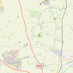
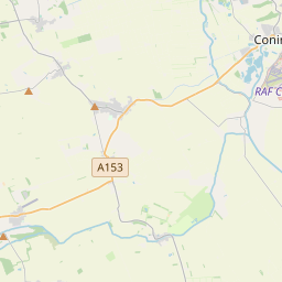

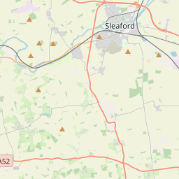
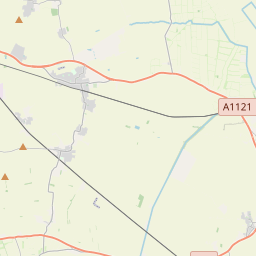

53.0399, -0.3397© OpenStreetMap
Lieux sous ce code
44| Lieu | Région | Comté | Coordonnées |
|---|---|---|---|
| Anwick | England | Lincolnshire | 53.0399, -0.3397 |
| Asgarby | England | Lincolnshire | 52.9991, -0.3348 |
| Aslackby | England | Lincolnshire | 52.8596, -0.3907 |
| Aswarby | England | Lincolnshire | 52.9464, -0.4147 |
| Aunsby | England | Lincolnshire | 52.9769, -0.3989 |
| Billingborough | England | Lincolnshire | 52.8938, -0.3419 |
| Birthorpe | England | Lincolnshire | 52.8908, -0.3617 |
| Braceby | England | Lincolnshire | 52.9769, -0.3989 |
| Bridge End | England | Lincolnshire | 52.9769, -0.3989 |
| Burton Pedwardine | England | Lincolnshire | 52.9648, -0.3365 |
| Cranwell | England | Lincolnshire | 53.0368, -0.4618 |
| Dembleby | England | Lincolnshire | 52.9769, -0.3989 |
| Evedon | England | Lincolnshire | 52.9769, -0.3989 |
| Ewerby | England | Lincolnshire | 53.0115, -0.3316 |
| Ewerby Thorpe | England | Lincolnshire | 52.9769, -0.3989 |
| Folkingham | England | Lincolnshire | 52.8892, -0.4074 |
| Great Hale | England | Lincolnshire | 52.9715, -0.2901 |
| Haceby | England | Lincolnshire | 52.912, -0.4701 |
| Heckington | England | Lincolnshire | 52.9818, -0.299 |
| Helpringham | England | Lincolnshire | 52.9513, -0.3062 |
| Holdingham | England | Lincolnshire | 52.9769, -0.3989 |
| Horbling | England | Lincolnshire | 52.9028, -0.3384 |
| Howell | England | Lincolnshire | 53.0019, -0.3088 |
| Kirkby la Thorpe | England | Lincolnshire | 52.9769, -0.3989 |
| Laughton | England | Lincolnshire | 52.9873, -0.394 |
| Leasingham | England | Lincolnshire | 53.0257, -0.4261 |
| Little Hale | England | Lincolnshire | 52.9607, -0.2954 |
| Newton | England | Lincolnshire | 52.9873, -0.394 |
| North Rauceby | England | Lincolnshire | 53.0025, -0.4753 |
| Osbournby | England | Lincolnshire | 52.9299, -0.4107 |
| Pickworth | England | Lincolnshire | 52.8895, -0.4513 |
| Pointon | England | Lincolnshire | 52.872, -0.343 |
| Quarrington | England | Lincolnshire | 52.9667, -0.4167 |
| Ruskington | England | Lincolnshire | 53.0454, -0.3869 |
| Sapperton | England | Lincolnshire | 52.9769, -0.3989 |
| Scredington | England | Lincolnshire | 52.9507, -0.3723 |
| Silk Willoughby | England | Lincolnshire | 52.9728, -0.4285 |
| Sleaford | England | Lincolnshire | 52.9983, -0.4094 |
| South Rauceby | England | Lincolnshire | 52.9955, -0.4706 |
| Spanby | England | Lincolnshire | 52.9293, -0.3742 |
| Swarby | England | Lincolnshire | 52.9526, -0.4434 |
| Swaton | England | Lincolnshire | 52.9236, -0.3163 |
| Threekingham | England | Lincolnshire | 52.9125, -0.3806 |
| Walcot | England | Lincolnshire | 52.903, -0.4254 |
Même code dans d'autres pays
0Ce code n'existe que dans ce pays.
FAQ
Dans quelle ville se trouve NG34 ?
Anwick, England, Royaume-Uni.
Quelles sont les coordonnées de NG34 ?
53.0399, -0.3397
NG34 est-il utilisé dans d'autres pays ?
Non.
Les données sont non officielles et tronquées ; pour les envois critiques, vérifiez avec le destinataire et le transporteur. Voir la source et la licence → · Mis à jour le 2026-11-09. Attribution dans