
Inggris Raya
HD8 kode pos
Detail kode pos
12 tempatKode
Tempat
Clayton West
Wilayah
England
Kabupaten
West Yorkshire
Koordinat
53.595, -1.6111
Akurasi
4 / 6
Negara
Inggris Raya
Lokasi
OpenStreetMap ↗


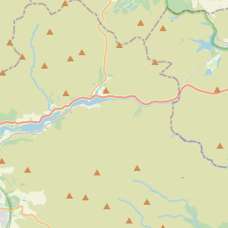


53.595, -1.6111© OpenStreetMap
Tempat di bawah kode ini
12| Tempat | Wilayah | Kabupaten | Koordinat |
|---|---|---|---|
| Clayton West | England | West Yorkshire | 53.595, -1.6111 |
| Cowmes | England | West Yorkshire | 53.5951, -1.6651 |
| Denby Dale | England | West Yorkshire | 53.5723, -1.659 |
| Emley | England | West Yorkshire | 53.6139, -1.6313 |
| Highburton | England | West Yorkshire | 53.5951, -1.6651 |
| Kirkburton | England | West Yorkshire | 53.6105, -1.7029 |
| Lane Head | England | West Yorkshire | 53.5951, -1.6651 |
| Lepton | England | West Yorkshire | 53.5951, -1.6651 |
| Shelley | England | West Yorkshire | 53.6, -1.6833 |
| Shepley | England | West Yorkshire | 53.5833, -1.7167 |
| Skelmanthorpe | England | West Yorkshire | 53.5906, -1.6517 |
| Upper Denby | England | West Yorkshire | 53.5951, -1.6651 |
Kode yang sama di negara lain
0Kode ini hanya muncul di negara ini.
FAQ
HD8 berada di kota mana?
Clayton West, England, Inggris Raya.
Apa koordinat HD8?
53.595, -1.6111
Apakah HD8 dipakai di negara lain?
Tidak.
Data ini tidak resmi dan memiliki pemotongan yang diketahui; verifikasi dengan penerima dan kurir untuk pengiriman penting. Lihat sumber data & lisensi → · Diperbarui 2026-11-09. Atribusi di