
Regno Unito
DY9 codice postale
Dettagli del codice postale
10 luoghiCodice
Luogo
Belbroughton
Regione
England
Contea
Worcestershire
Coordinate
52.3918, -2.1188
Precisione
4 / 6
Paese
Regno Unito
Posizione
OpenStreetMap ↗

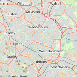


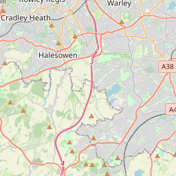


52.3918, -2.1188© OpenStreetMap
Luoghi con questo codice
10| Luogo | Regione | Contea | Coordinate |
|---|---|---|---|
| Belbroughton | England | Worcestershire | 52.3918, -2.1188 |
| Bell End | England | Worcestershire | 52.3739, -2.123 |
| Broome | England | Worcestershire | 52.4012, -2.1499 |
| Clent | England | Worcestershire | 52.4132, -2.1054 |
| Drayton | England | West Midlands | 52.4345, -2.1226 |
| Hagley | England | Worcestershire | 52.4262, -2.1282 |
| Holy Cross | England | Worcestershire | 52.3739, -2.123 |
| Lye | England | West Midlands | 52.4584, -2.117 |
| Pedmore | England | West Midlands | 52.4385, -2.1329 |
| West Hagley | England | Worcestershire | 52.3739, -2.123 |
Stesso codice in altri Paesi
0Questo codice compare solo in questo Paese.
FAQ
In quale città si trova DY9?
Belbroughton, England, Regno Unito.
Quali sono le coordinate di DY9?
52.3918, -2.1188
DY9 è usato in altri Paesi?
No.
I dati non sono ufficiali e presentano troncamenti noti; per le spedizioni critiche verifica con il destinatario e con il corriere. Vedi fonte e licenza dei dati → · Aggiornato il 2026-11-09. Attribuzione in