
Regno Unito
LE14 codice postale
Dettagli del codice postale
48 luoghiCodice
Luogo
Ab Kettleby
Regione
England
Contea
Leicestershire
Coordinate
52.8004, -0.9261
Precisione
4 / 6
Paese
Regno Unito
Posizione
OpenStreetMap ↗


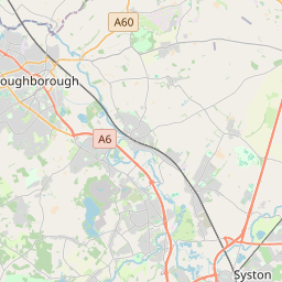


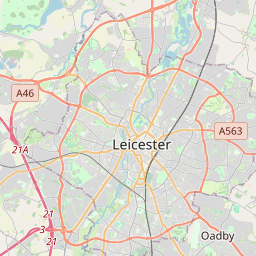


52.8004, -0.9261© OpenStreetMap
Luoghi con questo codice
48| Luogo | Regione | Contea | Coordinate |
|---|---|---|---|
| Ab Kettleby | England | Leicestershire | 52.8004, -0.9261 |
| Asfordby | England | Leicestershire | 52.7633, -0.9586 |
| Asfordby Hill | England | Leicestershire | 52.8094, -0.8701 |
| Ashby Folville | England | Leicestershire | 52.7008, -0.9554 |
| Brentingby | England | Leicestershire | 52.8094, -0.8701 |
| Brooksby | England | Leicestershire | 52.8094, -0.8701 |
| Burrough on the Hill | England | Leicestershire | 52.8094, -0.8701 |
| Burton Lazars | England | Leicestershire | 52.7441, -0.8642 |
| Chadwell | England | Leicestershire | 52.8, -0.8333 |
| Coston | England | Leicestershire | 52.7916, -0.7448 |
| Eastwell | England | Leicestershire | 52.85, -0.8497 |
| Edmondthorpe | England | Leicestershire | 52.7499, -0.726 |
| Freeby | England | Leicestershire | 52.7726, -0.8108 |
| Frisby on the Wreake | England | Leicestershire | 52.7513, -0.9701 |
| Garthorpe | England | Leicestershire | 52.7802, -0.7567 |
| Goadby Marwood | England | Leicestershire | 52.8297, -0.8408 |
| Great Dalby | England | Leicestershire | 52.7229, -0.9003 |
| Grimston | England | Leicestershire | 52.7901, -0.9866 |
| Harby | England | Leicestershire | 52.873, -0.8957 |
| Hickling | England | Nottinghamshire | 52.8505, -0.983 |
| Hoby | England | Leicestershire | 52.7508, -1.0095 |
| Holwell | England | Leicestershire | 52.7833, -0.9 |
| Hose | England | Leicestershire | 52.857, -0.9043 |
| Kirkby Bellars | England | Leicestershire | 52.8094, -0.8701 |
| Little Dalby | England | Leicestershire | 52.7195, -0.8485 |
| Long Clawson | England | Leicestershire | 52.8373, -0.9288 |
| Nether Broughton | England | Leicestershire | 52.8249, -0.9706 |
| Old Dalby | England | Leicestershire | 52.8071, -1.0031 |
| Pickwell | England | Leicestershire | 52.8094, -0.8701 |
| Ragdale | England | Leicestershire | 52.7715, -1.0199 |
| Rotherby | England | Leicestershire | 52.8094, -0.8701 |
| Saltby | England | Leicestershire | 52.8276, -0.7369 |
| Saxby | England | Leicestershire | 52.7716, -0.7859 |
| Saxelbye | England | Leicestershire | 52.8094, -0.8701 |
| Scalford | England | Leicestershire | 52.8096, -0.8696 |
| Somerby | England | Leicestershire | 52.6874, -0.8501 |
| Sproxton | England | Leicestershire | 52.8104, -0.7349 |
| Stapleford | England | Leicestershire | 52.7554, -0.7994 |
| Stathern | England | Leicestershire | 52.872, -0.8552 |
| Stonesby | England | Leicestershire | 52.8134, -0.7802 |
| Thorpe Arnold | England | Leicestershire | 52.8094, -0.8701 |
| Thorpe Satchville | England | Leicestershire | 52.6982, -0.9166 |
| Twyford | England | Leicestershire | 52.6844, -0.9237 |
| Upper Broughton | England | Nottinghamshire | 52.8286, -0.9877 |
| Waltham on the Wolds | England | Leicestershire | 52.817, -0.8084 |
| Wartnaby | England | Leicestershire | 52.8022, -0.9449 |
| Wycomb | England | Leicestershire | 52.8094, -0.8701 |
| Wymondham | England | Leicestershire | 52.7598, -0.7405 |
Stesso codice in altri Paesi
0Questo codice compare solo in questo Paese.
FAQ
In quale città si trova LE14?
Ab Kettleby, England, Regno Unito.
Quali sono le coordinate di LE14?
52.8004, -0.9261
LE14 è usato in altri Paesi?
No.
I dati non sono ufficiali e presentano troncamenti noti; per le spedizioni critiche verifica con il destinatario e con il corriere. Vedi fonte e licenza dei dati → · Aggiornato il 2026-11-09. Attribuzione in