
Regno Unito
NN6 codice postale
Dettagli del codice postale
43 luoghiCodice
Luogo
Brixworth
Regione
England
Contea
Northamptonshire
Coordinate
52.3291, -0.9035
Precisione
4 / 6
Paese
Regno Unito
Posizione
OpenStreetMap ↗


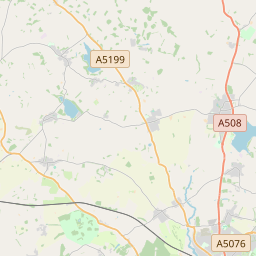
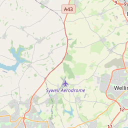

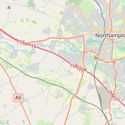
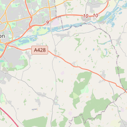
52.3291, -0.9035© OpenStreetMap
Luoghi con questo codice
43| Luogo | Regione | Contea | Coordinate |
|---|---|---|---|
| Brixworth | England | Northamptonshire | 52.3291, -0.9035 |
| Chapel Brampton | England | Northamptonshire | 52.2899, -0.9317 |
| Church Brampton | England | Northamptonshire | 52.287, -0.9433 |
| Clay Coton | England | Northamptonshire | 52.3881, -1.1259 |
| Cold Ashby | England | Northamptonshire | 52.3812, -1.0373 |
| Coton | England | Northamptonshire | 52.328, -0.9478 |
| Cottesbrooke | England | Northamptonshire | 52.3544, -0.9564 |
| Creaton | England | Northamptonshire | 52.3333, -0.95 |
| Crick | England | Northamptonshire | 52.3481, -1.1371 |
| Draughton | England | Northamptonshire | 52.3667, -0.8667 |
| Earls Barton | England | Northamptonshire | 52.2663, -0.7525 |
| East Haddon | England | Northamptonshire | 52.3072, -1.0236 |
| Ecton | England | Northamptonshire | 52.2654, -0.7891 |
| Faxton | England | Northamptonshire | 52.3667, -0.8333 |
| Guilsborough | England | Northamptonshire | 52.3513, -1.0102 |
| Hannington | England | Northamptonshire | 52.3302, -0.8076 |
| Harrington | England | Northamptonshire | 52.4, -0.85 |
| Haselbech | England | Northamptonshire | 52.3903, -0.9544 |
| Holcot | England | Northamptonshire | 52.3194, -0.839 |
| Holdenby | England | Northamptonshire | 52.305, -0.9793 |
| Hollowell | England | Northamptonshire | 52.3347, -0.9861 |
| Kelmarsh | England | Northamptonshire | 52.4062, -0.9181 |
| Lamport | England | Northamptonshire | 52.3635, -0.8914 |
| Long Buckby | England | Northamptonshire | 52.3026, -1.0811 |
| Maidwell | England | Northamptonshire | 52.3862, -0.9049 |
| Mears Ashby | England | Northamptonshire | 52.2925, -0.7724 |
| Naseby | England | Northamptonshire | 52.3942, -0.9893 |
| Old | England | Northamptonshire | 52.3529, -0.8453 |
| Overstone | England | Northamptonshire | 52.2914, -0.8152 |
| Pitsford | England | Northamptonshire | 52.3034, -0.8982 |
| Ravensthorpe | England | Northamptonshire | 52.3294, -1.0187 |
| Scaldwell | England | Northamptonshire | 52.3452, -0.8728 |
| Spratton | England | Northamptonshire | 52.3245, -0.9539 |
| Stanford on Avon | England | Northamptonshire | 52.4, -1.1333 |
| Sywell | England | Northamptonshire | 52.2986, -0.7973 |
| Teeton | England | Northamptonshire | 52.3214, -0.9267 |
| Thornby | England | Northamptonshire | 52.3748, -1.0167 |
| Walgrave | England | Northamptonshire | 52.3404, -0.8251 |
| Watford | England | Northamptonshire | 52.3169, -1.1158 |
| Welford | England | Northamptonshire | 52.4167, -1.05 |
| West Haddon | England | Northamptonshire | 52.3417, -1.078 |
| Winwick | England | Northamptonshire | 52.3615, -1.0864 |
| Yelvertoft | England | Northamptonshire | 52.3734, -1.1215 |
Stesso codice in altri Paesi
0Questo codice compare solo in questo Paese.
FAQ
In quale città si trova NN6?
Brixworth, England, Regno Unito.
Quali sono le coordinate di NN6?
52.3291, -0.9035
NN6 è usato in altri Paesi?
No.
I dati non sono ufficiali e presentano troncamenti noti; per le spedizioni critiche verifica con il destinatario e con il corriere. Vedi fonte e licenza dei dati → · Aggiornato il 2026-11-09. Attribuzione in