
สหราชอาณาจักร
LE7 รหัสไปรษณีย์
รายละเอียดรหัสไปรษณีย์
40 สถานที่รหัส
สถานที่
Anstey
ภูมิภาค
England
เขต
Leicestershire
พิกัด
52.6737, -1.1884
ความแม่นยำ
4 / 6
ประเทศ
สหราชอาณาจักร
ตำแหน่ง
OpenStreetMap ↗
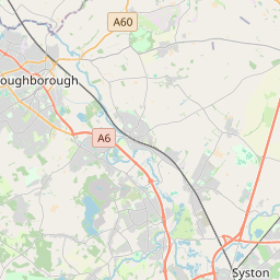


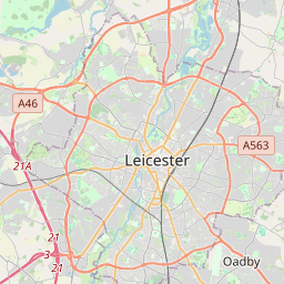


52.6737, -1.1884© OpenStreetMap
สถานที่ภายใต้รหัสนี้
40| สถานที่ | ภูมิภาค | เขต | พิกัด |
|---|---|---|---|
| Anstey | England | Leicestershire | 52.6737, -1.1884 |
| Barkby | England | Leicestershire | 52.6814, -1.0545 |
| Barkby Thorpe | England | Leicestershire | 52.6663, -1.0547 |
| Barsby | England | Leicestershire | 52.6955, -0.968 |
| Beeby | England | Leicestershire | 52.669, -1.018 |
| Billesdon | England | Leicestershire | 52.6186, -0.9415 |
| Bushby | England | Leicestershire | 52.6803, -1.0694 |
| Cold Newton | England | Leicestershire | 52.6452, -0.938 |
| Cossington | England | Leicestershire | 52.7185, -1.0967 |
| Cropston | England | Leicestershire | 52.6803, -1.0694 |
| East Goscote | England | Leicestershire | 52.7151, -1.053 |
| East Norton | England | Leicestershire | 52.5956, -0.8421 |
| Gaddesby | England | Leicestershire | 52.714, -0.9814 |
| Gaulby | England | Leicestershire | 52.6025, -0.9755 |
| Goadby | England | Leicestershire | 52.5819, -0.8945 |
| Halstead | England | Leicestershire | 52.6803, -1.0694 |
| Houghton on the Hill | England | Leicestershire | 52.6266, -0.9955 |
| Hungarton | England | Leicestershire | 52.656, -0.9775 |
| Illston on the Hill | England | Leicestershire | 52.588, -0.9555 |
| Keyham | England | Leicestershire | 52.652, -1.0094 |
| King's Norton | England | Leicestershire | 52.598, -0.9893 |
| Loddington | England | Leicestershire | 52.6, -0.8333 |
| Lowesby | England | Leicestershire | 52.6606, -0.9317 |
| Noseley | England | Leicestershire | 52.6803, -1.0694 |
| Queniborough | England | Leicestershire | 52.7059, -1.0475 |
| Ratcliffe on the Wreake | England | Leicestershire | 52.7167, -1.0667 |
| Rearsby | England | Leicestershire | 52.7267, -1.0338 |
| Rolleston | England | Leicestershire | 52.5978, -0.9262 |
| Rothley | England | Leicestershire | 52.7092, -1.1374 |
| Scraptoft | England | Leicestershire | 52.644, -1.0425 |
| Skeffington | England | Leicestershire | 52.6177, -0.9021 |
| South Croxton | England | Leicestershire | 52.6853, -0.9808 |
| Stoughton | England | Leicestershire | 52.6803, -1.0694 |
| Syston | England | Leicestershire | 52.6833, -1.0667 |
| Thrussington | England | Leicestershire | 52.7363, -1.0406 |
| Thurcaston | England | Leicestershire | 52.6923, -1.1593 |
| Thurnby | England | Leicestershire | 52.6331, -1.0442 |
| Tilton on the Hill | England | Leicestershire | 52.6434, -0.9032 |
| Tugby | England | Leicestershire | 52.6017, -0.8757 |
| Wanlip | England | Leicestershire | 52.6942, -1.1164 |
รหัสเดียวกันในประเทศอื่น
0รหัสนี้ปรากฏเฉพาะในประเทศนี้เท่านั้น
FAQ
LE7 อยู่ในเมืองใด?
Anstey, England, สหราชอาณาจักร
พิกัดของ LE7 คืออะไร?
52.6737, -1.1884
LE7 ถูกใช้ในประเทศอื่นด้วยหรือไม่?
ไม่
ข้อมูลไม่เป็นทางการและมีการตัดทอนที่ทราบอยู่แล้ว ตรวจสอบกับผู้รับและผู้ขนส่งสำหรับการจัดส่งที่สำคัญ ดูแหล่งที่มาและสัญญาอนุญาตของข้อมูล → · อัปเดต 2026-11-09 ดูการอ้างอิงที่