
สหราชอาณาจักร
LE9 รหัสไปรษณีย์
รายละเอียดรหัสไปรษณีย์
22 สถานที่รหัส
สถานที่
Barwell
ภูมิภาค
England
เขต
Leicestershire
พิกัด
52.5682, -1.3445
ความแม่นยำ
4 / 6
ประเทศ
สหราชอาณาจักร
ตำแหน่ง
OpenStreetMap ↗

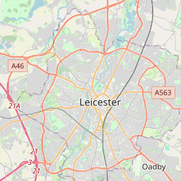


52.5682, -1.3445© OpenStreetMap
สถานที่ภายใต้รหัสนี้
22| สถานที่ | ภูมิภาค | เขต | พิกัด |
|---|---|---|---|
| Barwell | England | Leicestershire | 52.5682, -1.3445 |
| Botcheston | England | Leicestershire | 52.5739, -1.2819 |
| Broughton Astley | England | Leicestershire | 52.5279, -1.2177 |
| Cosby | England | Leicestershire | 52.5513, -1.1939 |
| Croft | England | Leicestershire | 52.5567, -1.2464 |
| Desford | England | Leicestershire | 52.626, -1.2939 |
| Earl Shilton | England | Leicestershire | 52.5768, -1.3154 |
| Elmesthorpe | England | Leicestershire | 52.5609, -1.3111 |
| Enderby | England | Leicestershire | 52.5878, -1.2062 |
| Huncote | England | Leicestershire | 52.5734, -1.2372 |
| Kirby Muxloe | England | Leicestershire | 52.6302, -1.2276 |
| Kirkby Mallory | England | Leicestershire | 52.6017, -1.3269 |
| Narborough | England | Leicestershire | 52.5667, -1.2 |
| Newbold Verdon | England | Leicestershire | 52.6296, -1.3422 |
| Newtown Unthank | England | Leicestershire | 52.5739, -1.2819 |
| Peckleton | England | Leicestershire | 52.597, -1.3345 |
| Primethorpe | England | Leicestershire | 52.5739, -1.2819 |
| Sapcote | England | Leicestershire | 52.5371, -1.279 |
| Stapleton | England | Leicestershire | 52.5739, -1.2819 |
| Stoney Stanton | England | Leicestershire | 52.5484, -1.2793 |
| Sutton in the Elms | England | Leicestershire | 52.5739, -1.2819 |
| Thurlaston | England | Leicestershire | 52.5887, -1.2622 |
รหัสเดียวกันในประเทศอื่น
0รหัสนี้ปรากฏเฉพาะในประเทศนี้เท่านั้น
FAQ
LE9 อยู่ในเมืองใด?
Barwell, England, สหราชอาณาจักร
พิกัดของ LE9 คืออะไร?
52.5682, -1.3445
LE9 ถูกใช้ในประเทศอื่นด้วยหรือไม่?
ไม่
ข้อมูลไม่เป็นทางการและมีการตัดทอนที่ทราบอยู่แล้ว ตรวจสอบกับผู้รับและผู้ขนส่งสำหรับการจัดส่งที่สำคัญ ดูแหล่งที่มาและสัญญาอนุญาตของข้อมูล → · อัปเดต 2026-11-09 ดูการอ้างอิงที่