
สหราชอาณาจักร
SA18 รหัสไปรษณีย์
รายละเอียดรหัสไปรษณีย์
20 สถานที่รหัส
สถานที่
Ammanford
ภูมิภาค
Wales
เขต
Carmarthenshire
พิกัด
51.7928, -3.9883
ความแม่นยำ
4 / 6
ประเทศ
สหราชอาณาจักร
ตำแหน่ง
OpenStreetMap ↗


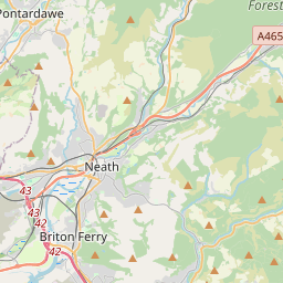
51.7928, -3.9883© OpenStreetMap
สถานที่ภายใต้รหัสนี้
20| สถานที่ | ภูมิภาค | เขต | พิกัด |
|---|---|---|---|
| Ammanford | Wales | Carmarthenshire | 51.7928, -3.9883 |
| Betws | Wales | Carmarthenshire | 51.7977, -3.9605 |
| Blaengweche | Wales | Carmarthenshire | 51.7804, -3.9482 |
| Brynamman | Wales | Carmarthenshire | 51.8, -3.8667 |
| Capel Hendre | Wales | Carmarthenshire | 51.7828, -4.0419 |
| Cwmgors | Wales | Neath Port Talbot | 51.7804, -3.9482 |
| Derwydd | Wales | Carmarthenshire | 51.8411, -4.0157 |
| Garnant | Wales | Carmarthenshire | 51.8015, -3.9056 |
| Garnswllt | Wales | Swansea | 51.7804, -3.9482 |
| Glanaman | Wales | Carmarthenshire | 51.7804, -3.9482 |
| Gwaun-Cae-Gurwen | Wales | Neath Port Talbot | 51.7804, -3.9482 |
| Gwaun-leision | Wales | Neath Port Talbot | 51.7804, -3.9482 |
| Llandybie | Wales | Carmarthenshire | 51.8204, -4.0071 |
| Lower Brynamman | Wales | Neath Port Talbot | 51.7804, -3.9482 |
| Pantyffynnon | Wales | Carmarthenshire | 51.7804, -3.9482 |
| Pentre Gwenlais | Wales | Carmarthenshire | 51.8266, -4.0196 |
| Pontamman | Wales | Carmarthenshire | 51.7804, -3.9482 |
| Saron | Wales | Carmarthenshire | 51.7919, -4.0283 |
| Tir-y-dail | Wales | Carmarthenshire | 51.7804, -3.9482 |
| Tycroes | Wales | Carmarthenshire | 51.7781, -4.02 |
รหัสเดียวกันในประเทศอื่น
0รหัสนี้ปรากฏเฉพาะในประเทศนี้เท่านั้น
FAQ
SA18 อยู่ในเมืองใด?
Ammanford, Wales, สหราชอาณาจักร
พิกัดของ SA18 คืออะไร?
51.7928, -3.9883
SA18 ถูกใช้ในประเทศอื่นด้วยหรือไม่?
ไม่
ข้อมูลไม่เป็นทางการและมีการตัดทอนที่ทราบอยู่แล้ว ตรวจสอบกับผู้รับและผู้ขนส่งสำหรับการจัดส่งที่สำคัญ ดูแหล่งที่มาและสัญญาอนุญาตของข้อมูล → · อัปเดต 2026-11-09 ดูการอ้างอิงที่