
Vereinigtes Königreich
PE20 Postleitzahl
PLZ-Details
21 OrtePLZ
Ort
Algarkirk
Region
England
Kreis
Lincolnshire
Koordinaten
52.8992, -0.0813
Genauigkeit
4 / 6
Land
Vereinigtes Königreich
Lage
OpenStreetMap ↗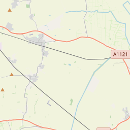


52.8992, -0.0813© OpenStreetMap
Orte unter dieser PLZ
21| Ort | Region | Kreis | Koordinaten |
|---|---|---|---|
| Algarkirk | England | Lincolnshire | 52.8992, -0.0813 |
| Amber Hill | England | Lincolnshire | 53.0068, -0.1653 |
| Bicker | England | Lincolnshire | 52.9216, -0.1796 |
| Brothertoft | England | Lincolnshire | 52.9958, -0.1038 |
| Drayton | England | Lincolnshire | 52.9167, -0.15 |
| East Heckington | England | Lincolnshire | 53.0004, -0.1614 |
| Fenhouses | England | Lincolnshire | 53.0004, -0.1614 |
| Fosdyke | England | Lincolnshire | 52.8803, -0.0459 |
| Frampton | England | Lincolnshire | 52.9344, -0.03 |
| Frampton West End | England | Lincolnshire | 53.0004, -0.1614 |
| Hoffleet Stow | England | Lincolnshire | 53.0004, -0.1614 |
| Hubbert's Bridge | England | Lincolnshire | 53.0004, -0.1614 |
| Kirton | England | Lincolnshire | 52.9277, -0.0601 |
| Kirton End | England | Lincolnshire | 53.0004, -0.1614 |
| Kirton Holme | England | Lincolnshire | 53.0004, -0.1614 |
| Sandholme | England | Lincolnshire | 52.9315, -0.1041 |
| Skeldyke | England | Lincolnshire | 53.0004, -0.1614 |
| Sutterton | England | Lincolnshire | 52.9027, -0.0924 |
| Swineshead | England | Lincolnshire | 52.9454, -0.1595 |
| Swineshead Bridge | England | Lincolnshire | 53.0004, -0.1614 |
| Wigtoft | England | Lincolnshire | 52.9082, -0.1229 |
Gleiche PLZ in anderen Ländern
0Diese PLZ kommt nur in diesem Land vor.
FAQ
In welcher Stadt liegt PE20?
Algarkirk, England, Vereinigtes Königreich.
Welche Koordinaten hat PE20?
52.8992, -0.0813
Wird PE20 auch in anderen Ländern verwendet?
Nein.
Die Daten sind inoffiziell und gekürzt; bei kritischen Sendungen Adresse und Carrier prüfen. Quelle & Lizenz ansehen → · Aktualisiert am 2026-11-09. Quellenangabe in