
Reino Unido
DE13 código postal
Detalles del código postal
21 lugaresCódigo
Lugar
Alrewas
Región
England
Condado
Staffordshire
Coordenadas
52.7328, -1.7497
Precisión
4 / 6
País
Reino Unido
Ubicación
OpenStreetMap ↗
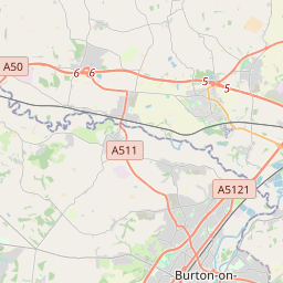
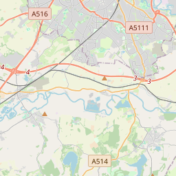


52.7328, -1.7497© OpenStreetMap
Lugares con este código
21| Lugar | Región | Condado | Coordenadas |
|---|---|---|---|
| Alrewas | England | Staffordshire | 52.7328, -1.7497 |
| Anslow | England | Staffordshire | 52.8255, -1.6868 |
| Anslow Gate | England | Staffordshire | 52.8076, -1.6919 |
| Barton-under-Needwood | England | Staffordshire | 52.7627, -1.724 |
| Dunstall | England | Staffordshire | 52.7667, -1.7333 |
| Hadley End | England | Staffordshire | 52.8076, -1.6919 |
| Hanbury | England | Staffordshire | 52.847, -1.7447 |
| Hanbury Woodend | England | Staffordshire | 52.8076, -1.6919 |
| Hoar Cross | England | Staffordshire | 52.8071, -1.8093 |
| Horninglow | England | Staffordshire | 52.8224, -1.6422 |
| King's Bromley | England | Staffordshire | 52.7481, -1.8198 |
| Morrey | England | Staffordshire | 52.8076, -1.6919 |
| Newborough | England | Staffordshire | 52.8167, -1.8 |
| Orgreave | England | Staffordshire | 52.8076, -1.6919 |
| Rangemore | England | Staffordshire | 52.8076, -1.6919 |
| Rolleston | England | Staffordshire | 52.8452, -1.646 |
| Stretton | England | Staffordshire | 52.8325, -1.6279 |
| Tatenhill | England | Staffordshire | 52.7916, -1.6995 |
| Tutbury | England | Staffordshire | 52.856, -1.6865 |
| Woodhouses | England | Staffordshire | 52.8076, -1.6919 |
| Yoxall | England | Staffordshire | 52.7666, -1.7907 |
Mismo código en otros países
0Este código solo aparece en este país.
FAQ
¿En qué ciudad está DE13?
Alrewas, England, Reino Unido.
¿Cuáles son las coordenadas de DE13?
52.7328, -1.7497
¿Se usa DE13 en otros países?
No.
Los datos no son oficiales y presentan truncamientos conocidos; verifica con el destinatario y el transportista en los envíos críticos. Ver la fuente y la licencia de los datos → · Actualizado el 2026-11-09. Atribución en