
Reino Unido
TF13 código postal
Detalles del código postal
14 lugaresCódigo
Lugar
Bourton
Región
England
Condado
Shropshire
Coordenadas
52.5667, -2.6
Precisión
4 / 6
País
Reino Unido
Ubicación
OpenStreetMap ↗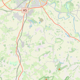
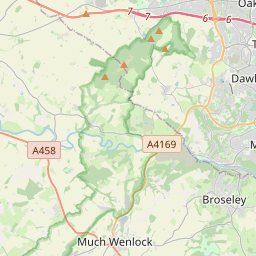


52.5667, -2.6© OpenStreetMap
Lugares con este código
14| Lugar | Región | Condado | Coordenadas |
|---|---|---|---|
| Bourton | England | Shropshire | 52.5667, -2.6 |
| Brockton | England | Shropshire | 52.5793, -2.5809 |
| East Wall | England | Shropshire | 52.5793, -2.5809 |
| Easthope | England | Shropshire | 52.5533, -2.6407 |
| Holdgate | England | Shropshire | 52.5793, -2.5809 |
| Homer | England | Shropshire | 52.5793, -2.5809 |
| Longville in the Dale | England | Shropshire | 52.5397, -2.6803 |
| Much Wenlock | England | Shropshire | 52.5958, -2.5575 |
| Presthope | England | Shropshire | 52.5727, -2.6179 |
| Shipton | England | Shropshire | 52.525, -2.6452 |
| Stanton Long | England | Shropshire | 52.5119, -2.631 |
| Stretton Westwood | England | Shropshire | 52.5793, -2.5809 |
| Weston | England | Shropshire | 52.5793, -2.5809 |
| Wyke | England | Shropshire | 52.5793, -2.5809 |
Mismo código en otros países
0Este código solo aparece en este país.
FAQ
¿En qué ciudad está TF13?
Bourton, England, Reino Unido.
¿Cuáles son las coordenadas de TF13?
52.5667, -2.6
¿Se usa TF13 en otros países?
No.
Los datos no son oficiales y presentan truncamientos conocidos; verifica con el destinatario y el transportista en los envíos críticos. Ver la fuente y la licencia de los datos → · Actualizado el 2026-11-09. Atribución en