
United Kingdom
GL14 post code
Post code details
13 placesCode
Place
Awre
Region
England
County
Gloucestershire
Coordinates
51.7733, -2.4297
Accuracy
4 / 6
Country
United Kingdom
Location
OpenStreetMap ↗

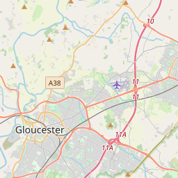


51.7733, -2.4297© OpenStreetMap
Places under this code
13| Place | Region | County | Coordinates |
|---|---|---|---|
| Awre | England | Gloucestershire | 51.7733, -2.4297 |
| Boxbush | England | Gloucestershire | 51.8173, -2.4799 |
| Brierley | England | Gloucestershire | 51.8173, -2.4799 |
| Cinderford | England | Gloucestershire | 51.8242, -2.4987 |
| Elton | England | Gloucestershire | 51.8173, -2.4799 |
| Flaxley | England | Gloucestershire | 51.8345, -2.451 |
| Little-dean | England | Gloucestershire | 51.818, -2.4786 |
| Newnham | England | Gloucestershire | 51.8052, -2.453 |
| Northwood Green | England | Gloucestershire | 51.8173, -2.4799 |
| Rodley | England | Gloucestershire | 51.8173, -2.4799 |
| Ruspidge | England | Gloucestershire | 51.8173, -2.4799 |
| Upper Soudley | England | Gloucestershire | 51.8173, -2.4799 |
| Westbury-on-Severn | England | Gloucestershire | 51.8237, -2.4119 |
Same code in other countries
0This code only appears in this country.
FAQ
Which city is GL14 in?
Awre, England, United Kingdom.
What are the coordinates of GL14?
51.7733, -2.4297
Is GL14 used in other countries?
No.
The data is unofficial and has known truncation; verify with the recipient and carrier for critical shipments. See data source & license → · Updated 2026-11-09. Attribution in