
United Kingdom
LL22 post code
Post code details
19 placesCode
Place
Abergele
Region
Wales
County
Conwy
Coordinates
53.2844, -3.5822
Accuracy
4 / 6
Country
United Kingdom
Location
OpenStreetMap ↗


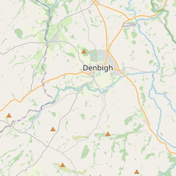
53.2844, -3.5822© OpenStreetMap
Places under this code
19| Place | Region | County | Coordinates |
|---|---|---|---|
| Abergele | Wales | Conwy | 53.2844, -3.5822 |
| Betws-yn-Rhos | Wales | Conwy | 53.2492, -3.6375 |
| Dawn | Wales | Conwy | 53.173, -3.6738 |
| Dolwen | Wales | Conwy | 53.173, -3.6738 |
| Gell | Wales | Conwy | 53.173, -3.6738 |
| Groesffordd Marli | Wales | Denbighshire | 53.173, -3.6738 |
| Gwytherin | Wales | Conwy | 53.1412, -3.678 |
| Hafodunos | Wales | Conwy | 53.173, -3.6738 |
| Kinmel Bay | Wales | Conwy | 53.3123, -3.5172 |
| Llanddulas | Wales | Conwy | 53.2899, -3.6422 |
| Llanfair Talhaiarn | Wales | Conwy | 53.2175, -3.6075 |
| Llangernyw | Wales | Conwy | 53.173, -3.6738 |
| Pandy Tudur | Wales | Conwy | 53.173, -3.6738 |
| Pensarn | Wales | Conwy | 53.173, -3.6738 |
| Pentre Isaf | Wales | Conwy | 53.173, -3.6738 |
| Rhyd-y-foel | Wales | Conwy | 53.2899, -3.6422 |
| St George | Wales | Conwy | 53.173, -3.6738 |
| Towyn | Wales | Conwy | 53.2677, -3.5972 |
| Wenlli | Wales | Conwy | 53.173, -3.6738 |
Same code in other countries
0This code only appears in this country.
FAQ
Which city is LL22 in?
Abergele, Wales, United Kingdom.
What are the coordinates of LL22?
53.2844, -3.5822
Is LL22 used in other countries?
No.
The data is unofficial and has known truncation; verify with the recipient and carrier for critical shipments. See data source & license → · Updated 2026-11-09. Attribution in