
Regno Unito
NG12 codice postale
Dettagli del codice postale
19 luoghiCodice
Luogo
Bassingfield
Regione
England
Contea
Nottinghamshire
Coordinate
52.9062, -1.0441
Precisione
3 / 6
Paese
Regno Unito
Posizione
OpenStreetMap ↗


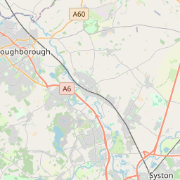


52.9062, -1.0441© OpenStreetMap
Luoghi con questo codice
19| Luogo | Regione | Contea | Coordinate |
|---|---|---|---|
| Bassingfield | England | Nottinghamshire | 52.9062, -1.0441 |
| Clipston-on-the-Wolds | England | Nottinghamshire | 52.9062, -1.0441 |
| Colston Bassett | England | Nottinghamshire | 52.8941, -0.9658 |
| Cotgrave | England | Nottinghamshire | 52.9086, -1.0375 |
| Cropwell Bishop | England | Nottinghamshire | 52.9148, -0.9848 |
| Cropwell Butler | England | Nottinghamshire | 52.9283, -0.9845 |
| Edwalton | England | Nottinghamshire | 52.9157, -1.1115 |
| Holme Pierrepont | England | Nottinghamshire | 52.9472, -1.0689 |
| Keyworth | England | Nottinghamshire | 52.8742, -1.0872 |
| Kinoulton | England | Nottinghamshire | 52.8714, -0.9917 |
| Normanton-on-the-Wolds | England | Nottinghamshire | 52.8902, -1.0756 |
| Owthorpe | England | Nottinghamshire | 52.8881, -1.0038 |
| Plumtree | England | Nottinghamshire | 52.8914, -1.09 |
| Radcliffe on Trent | England | Nottinghamshire | 52.948, -1.0386 |
| Shelford | England | Nottinghamshire | 52.9724, -1.0154 |
| Stanton-on-the-Wolds | England | Nottinghamshire | 52.9062, -1.0441 |
| Tollerton | England | Nottinghamshire | 52.9167, -1.0833 |
| Widmerpool | England | Nottinghamshire | 52.8482, -1.0667 |
| Wysall | England | Nottinghamshire | 52.8401, -1.1036 |
Stesso codice in altri Paesi
0Questo codice compare solo in questo Paese.
FAQ
In quale città si trova NG12?
Bassingfield, England, Regno Unito.
Quali sono le coordinate di NG12?
52.9062, -1.0441
NG12 è usato in altri Paesi?
No.
I dati non sono ufficiali e presentano troncamenti noti; per le spedizioni critiche verifica con il destinatario e con il corriere. Vedi fonte e licenza dei dati → · Aggiornato il 2026-11-09. Attribuzione in