
Reino Unido
NG12 código postal
Detalhes do código postal
19 locaisCódigo
Local
Bassingfield
Região
England
Condado
Nottinghamshire
Coordenadas
52.9062, -1.0441
Precisão
3 / 6
País
Reino Unido
Localização
OpenStreetMap ↗


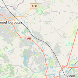


52.9062, -1.0441© OpenStreetMap
Locais com este código
19| Local | Região | Condado | Coordenadas |
|---|---|---|---|
| Bassingfield | England | Nottinghamshire | 52.9062, -1.0441 |
| Clipston-on-the-Wolds | England | Nottinghamshire | 52.9062, -1.0441 |
| Colston Bassett | England | Nottinghamshire | 52.8941, -0.9658 |
| Cotgrave | England | Nottinghamshire | 52.9086, -1.0375 |
| Cropwell Bishop | England | Nottinghamshire | 52.9148, -0.9848 |
| Cropwell Butler | England | Nottinghamshire | 52.9283, -0.9845 |
| Edwalton | England | Nottinghamshire | 52.9157, -1.1115 |
| Holme Pierrepont | England | Nottinghamshire | 52.9472, -1.0689 |
| Keyworth | England | Nottinghamshire | 52.8742, -1.0872 |
| Kinoulton | England | Nottinghamshire | 52.8714, -0.9917 |
| Normanton-on-the-Wolds | England | Nottinghamshire | 52.8902, -1.0756 |
| Owthorpe | England | Nottinghamshire | 52.8881, -1.0038 |
| Plumtree | England | Nottinghamshire | 52.8914, -1.09 |
| Radcliffe on Trent | England | Nottinghamshire | 52.948, -1.0386 |
| Shelford | England | Nottinghamshire | 52.9724, -1.0154 |
| Stanton-on-the-Wolds | England | Nottinghamshire | 52.9062, -1.0441 |
| Tollerton | England | Nottinghamshire | 52.9167, -1.0833 |
| Widmerpool | England | Nottinghamshire | 52.8482, -1.0667 |
| Wysall | England | Nottinghamshire | 52.8401, -1.1036 |
O mesmo código noutros países
0Este código só aparece neste país.
FAQ
Em que cidade fica NG12?
Bassingfield, England, Reino Unido.
Quais são as coordenadas de NG12?
52.9062, -1.0441
O NG12 é usado noutros países?
Não.
Os dados não são oficiais e têm truncamentos conhecidos; confirme com o destinatário e a transportadora em envios críticos. Ver origem e licença dos dados → · Atualizado em 2026-11-09. Atribuição em